


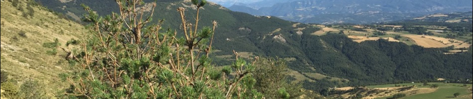
COL de CONODE depuis LA ROCHE des ARNAUDS-13-08-2016

RD78-38
User


7h29
Difficulty : Medium

FREE GPS app for hiking
 SityTrail
IGN / Geographical institutes
SityTrail Plus
The world is yours!
About
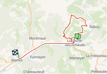
Trail Walking of 33 km to be discovered at Provence-Alpes-Côte d'Azur, Hautes-Alpes, La Roche-des-Arnauds. This trail is proposed by RD78-38.
Description
Randonnée de difficulté moyenne, aucun passage difficile. Superbes panoramas. 2éme partie du retour un peu long et panoramas moins spectaculaires. Randonnée à faire si l'on a un peu de temps (20 km) dénivelé moyen (1000 m cumulés)
Photos


21 photos in total. Please click on a photo to see them all in the gallery.
Positioning
Comments